Thursday, December 23, 2010
Leaving the Rockies
We spent a day in Rocky Mountain NP but was unable to see much other than snow. It is a place to return. Came across a herd of big horn sheep along the route, as we wrapped up our time in Colorado and headed towards Ohio.
Wednesday, December 15, 2010
Got Oxygen?
We've progressively been rising in elevation over the past week. Think we reached our summit while snowboarding at A-Basin (13,050ft, highest skiable terrain in N. America). Had a great time catching up with an old friend, and making new ones. Thanks for everything guys, the mountain definately won...but we had a great time, and look forward to our return trip. (**TIP: To avoid elevation sickness, eat regularly and drink HEAPS of water, not beer.)
Dom,
our gracious host
Kava Night
Arapahoe Basin
Montezuma Bowl
Sunset A-Basin
Thursday, December 9, 2010
Mesa Verde
Mixed emotions of the history between land and life lived among the cliffs by the Puebloan people. On one hand the masonry alone is admirable as you walk amongst dwellings that have existed for hundreds of years. On the other, the reasons for which these people retreated to the cliffs in the first place and later mysteriously migrated, leaves many questions. A very unique visit, filled with bright stars and kind people. A spiritual place we won't soon forget.
Spruce Tree House
Entrance to Kiva
Inside Kiva
(important underground ceremonial gathering places)
Cliff Palace
(had 150 rooms, 23 kivas, and a population @ 100)
...a wild herd bids us farewell...
Canyonlands, Part 2
Our last stop in southern Utah. Farewell, we will be back!
Newspaper Rock
Petroglyphs recording 2,000 years
Monday, December 6, 2010
Arches
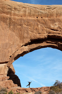
"Don't just stand there, do something"
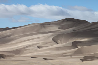
Petrified sand dunes
Landscape Arch
Delicate Arch
If only I could do it all over again. On this day I felt utterly bested. -J
Reminds us of your lil truck Molly, o the possibilities!
Canyonlands, Part 1
Between the lands of canyon and mountain, lies the raven.
Human impact is seen from many angles. The top of the canyons were used for grazing, and the many roads seen throughout the canyon were used for mining uranium, before the area was preserved as a National Park.
Capital Reef
Where the forces of the Earth have created the Waterpocket Fold. Due to wind, water and the process of erosion, the many geographic layers become visible and continuously create new features in the rock. Thus, creating a beautifully colored landscape resembling rainbow calcite. Hard to fit in a lense...but truly a hidden gem.
Thursday, December 2, 2010
Land of the Hoodoos
Wow and Brrrr. Bryce Canyon, although not really a canyon, is sandstone naturally eroded by 200 nights a year of freezing and thawing precipitation...eventually creating the formation of the hoodoos. After not being able to hike into the Grand Canyon due to ice, we acquired some "yaktrax" to help in the journey down amongst the hoodoos. We figured this was way cheaper than breaking a hip or leg or worse! Now, we're unstoppable! The energy is amazing in this place, and unlike anything we've seen yet. (Bryce, now we know why you're so special :) )
Inspiration Point overview
Hoodoos
Winter Rose?
The cliffs erode into arch form and then into the hoodoos
Relaxing after the hike
notice the "yaktrax"
Zion
There is no question as you explore this place as to how it acquired such a name. We happened to be visiting just as a snow storm hit, therefore seeing much of the area in a blanket of white.
Sandstone cliffs carved by the Virgin River
The Watchmen
The day after the storm...
back to clear blue skies
The Three Patriarchs: Abraham, Isaac, and Jacob
Remnants of the storm
Sunset from our riverside campspot, courtesy of BLM
Subscribe to:
Comments (Atom)


